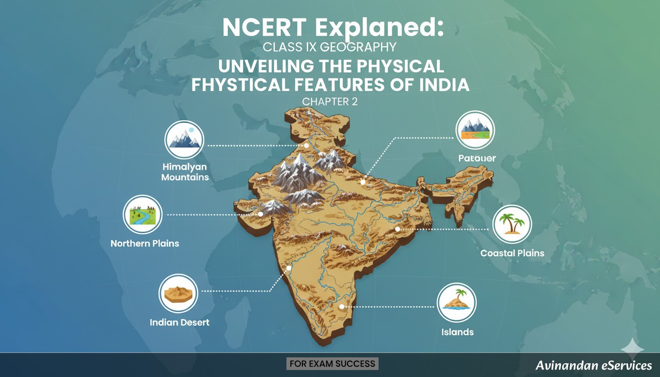
Introduction to the Topic
Have you ever looked at a map of India and wondered why it looks the way it does? Why are there towering, snow-capped mountains in the north, a vast, flat plain in the middle, and a dry, sandy desert in the west? India is a country of incredible physical diversity. It's a land where you can experience the biting cold of the Himalayas, the scorching heat of a desert, the humidity of a coastal plain, and the moderate climate of a plateau, all within its borders. This geographical variety is not just beautiful to look at; it profoundly influences our country's climate, economy, culture, and way of life.
This blog post will take you on a journey through Chapter 2, 'Physical Features of India,' from your NCERT Class IX Geography textbook, 'Contemporary India – I.' We will explore the six major physiographic divisions of India, from the majestic Himalayas to the serene islands. Our goal is to understand how these magnificent landforms came to be and what makes each of them unique. The formation of these features is a story that goes back millions of years, driven by the powerful forces of plate tectonics. The Indian subcontinent was once part of a supercontinent called Gondwana land. Over millions of years, the crust split, and the Indo-Australian plate drifted northwards to collide with the much larger Eurasian plate. This monumental collision buckled the Earth's crust, leading to the formation of the Himalayas. The subsequent formation of a large basin at the foot of the Himalayas, filled with sediments by rivers, created the fertile Northern Plains. So, let's dive in and unravel the fascinating story of India's physical landscape!
Key Concepts Explained
India's vast and varied landmass can be broadly divided into six distinct physiographic divisions. Each division has its own unique characteristics in terms of geology, relief, and resources. Let's explore them one by one.
1. The Himalayan Mountains: The Majestic Northern Wall
Stretching across the northern borders of India, the Himalayas are geologically young and structurally fold mountains. They are not just a single mountain range but a series of almost parallel ranges forming an arc of about 2,400 km. Their width varies from 400 km in Kashmir to 150 km in Arunachal Pradesh. The Himalayas are a formidable barrier, influencing the climate and serving as a source for mighty rivers.
The Himalayas can be understood through two types of divisions: longitudinal (north to south) and latitudinal (west to east).
Longitudinal Divisions (from North to South)
- The Great or Inner Himalayas (Himadri): This is the northernmost range and is the most continuous, with an average height of 6,000 meters. It contains all the prominent Himalayan peaks, including Mount Everest (in Nepal), Kanchenjunga (in India), Makalu, and Dhaulagiri. The core of this part is composed of granite. Being perpetually snow-bound, it is the source of numerous glaciers, which in turn feed the perennial rivers of North India.
- The Lesser Himalayas or Himachal: Lying south of the Himadri, this range is the most rugged. The altitude varies between 3,700 and 4,500 meters. Famous ranges like the Pir Panjal (the longest), the Dhaula Dhar, and the Mahabharat ranges are part of the Himachal. This range is renowned for its beautiful valleys like Kashmir, Kangra, and Kullu Valley, which are also famous hill stations like Shimla, Mussoorie, and Nainital.
- The Outer Himalayas or Shiwaliks: This is the outermost range of the Himalayas, with a width of 10-50 km and an altitude varying between 900 and 1,100 meters. These ranges are composed of unconsolidated sediments brought down by rivers from the main Himalayan ranges located farther north. The valleys lying between the Lesser Himalayas and the Shiwaliks are known as 'Duns.' Dehra Dun, Kotli Dun, and Patli Dun are some of the well-known Duns.
Divisions from West to East (demarcated by river valleys)
- Punjab Himalayas: This part lies between the Indus and Satluj rivers. It is also known regionally as Kashmir and Himachal Himalaya.
- Kumaon Himalayas: This section lies between the Satluj and Kali rivers.
- Nepal Himalayas: This part lies between the Kali and Tista rivers.
- Assam Himalayas: This part lies between the Tista and Dihang rivers.
Beyond the Dihang gorge, the Himalayas bend sharply to the south and spread along the eastern boundary of India. They are known as the Purvachal or the Eastern hills and mountains. These hills are mostly composed of strong sandstones and run as parallel ranges and valleys. The Purvachal comprises the Patkai hills, the Naga hills, the Manipur hills, and the Mizo hills.
2. The Northern Plain: India's Food Basket
Stretching south of the Himalayas is the vast Northern Plain. This plain is formed by the interplay of three major river systems – the Indus, the Ganga, and the Brahmaputra – along with their tributaries. Formed from the alluvial soil deposited by these rivers over millions of years, this plain is one of the most fertile and densely populated regions in the world. It covers an area of about 7 lakh sq. km and is about 2,400 km long and 240 to 320 km broad.
With a rich soil cover, adequate water supply, and a favorable climate, it is the agricultural heartland of India, often called the 'Food Bowl of India'.
Sections of the Northern Plain
- The Punjab Plains: The western part of the Northern Plain, formed by the Indus and its tributaries like the Jhelum, Chenab, Ravi, Beas, and Satluj. A large portion of this plain lies in Pakistan. The section dominated by 'doabs' (land between two rivers) is very fertile.
- The Ganga Plain: This is the largest part of the Northern Plain, \textending between the Ghaggar and Teesta rivers. It spreads over the states of North India – Haryana, Delhi, Uttar Pradesh, Bihar, parts of Jharkhand, and West Bengal.
- The Brahmaputra Plain: This lies in the east, particularly in the state of Assam, and is formed by the Brahmaputra river.
Divisions based on Relief Features
The Northern Plains are not entirely flat. They have diverse relief features. From north to south, they can be divided into four regions:
- Bhabar: After descending from the mountains, the rivers deposit pebbles in a narrow belt of about 8 to 16 km in width, lying parallel to the slopes of the Shiwaliks. This belt is known as the Bhabar. All the streams disappear in this Bhabar belt because of the high porosity.
- Terai: South of the Bhabar belt, the streams and rivers re-emerge and create a wet, swampy, and marshy region known as the Terai. This was once a thickly forested region full of wildlife. Many forests have now been cleared to create agricultural land.
- Bhangar: This is the largest part of the northern plain and is formed of older alluvium. It lies above the flood plains of the rivers and presents a terrace-like feature. The soil in this region contains calcareous deposits locally known as 'kankar'. It is less fertile than the Khadar.
- Khadar: The newer, younger deposits of the flood plains are called Khadar. They are renewed almost every year and so are very fertile, making them ideal for intensive agriculture.
3. The Peninsular Plateau: The Ancient Landmass
The Peninsular Plateau is a tableland composed of old crystalline, igneous, and metamorphic rocks. It was formed due to the breaking and drifting of the Gondwana land, making it one of the oldest landmasses on Earth. This plateau has broad and shallow valleys and rounded hills. Its distinct features include block mountains and rift valleys.
The plateau is broadly divided into two regions:
The Central Highlands
This part of the Peninsular plateau lies to the north of the Narmada river, covering a major area of the Malwa plateau. The Vindhyan range bounds it on the south and the Aravallis on the northwest. The Aravalli hills are one of the oldest mountain ranges in the world. The further eastward \textension of this plateau is locally known as Bundelkhand and Baghelkhand. The Chotanagpur plateau marks the further eastward \textension, drained by the Damodar river. This region is a rich storehouse of minerals like coal, iron ore, and manganese, making it the industrial hub of India.
The Deccan Plateau
This is a triangular landmass that lies to the south of the river Narmada. The Satpura range flanks its broad base in the north, while the Mahadev, the Kaimur hills, and the Maikal range form its eastern \textensions. The Deccan Plateau is higher in the west and slopes gently eastwards. A distinct feature of this region is the Deccan Trap, a black soil area of volcanic origin. These volcanic rocks have denuded over time and are responsible for the formation of black soil, which is ideal for cotton cultivation.
The Deccan Plateau is flanked by the Western Ghats and the Eastern Ghats:
- The Western Ghats: They run parallel to the western coast. They are continuous and can be crossed through passes only. They are higher than the Eastern Ghats, with an average elevation of 900–1600 meters. The Western Ghats cause orographic rain by forcing rain-bearing moist winds to rise along their western slopes. The height of the Western Ghats progressively increases from north to south. The highest peaks include the Anai Mudi (2,695 metres) and the Doda Betta (2,637 metres).
- The Eastern Ghats: They stretch from the Mahanadi Valley to the Nilgiris in the south. The Eastern Ghats are discontinuous and irregular, and have been dissected by rivers flowing into the Bay of Bengal (like Mahanadi, Godavari, Krishna, and Kaveri). Mahendragiri (1,501 metres) is the highest peak in the Eastern Ghats. The Western Ghats and the Eastern Ghats meet at the Nilgiri hills.
4. The Indian Desert: The Arid Expanse
To the west of the Aravalli Hills lies the great Indian Desert, also known as the Thar Desert. It is an undulating sandy plain covered with sand dunes. This region receives very low rainfall, below 150 mm per year. As a result, it has an arid climate with low vegetation cover. Streams appear during the rainy season but soon disappear into the sand as they do not have enough water to reach the sea. The Luni is the only large river in this region.
A prominent feature of the Thar desert is its sand dunes. Barchans (crescent-shaped dunes) cover larger areas, but longitudinal dunes become more prominent near the Indo-Pakistan boundary. This seemingly inhospitable land is home to unique flora and fauna adapted to the harsh conditions.
5. The Coastal Plains: The Seaward Margins
Flanking the Peninsular Plateau are stretches of narrow coastal strips, running along the Arabian Sea on the west and the Bay of Bengal on the east.
The Western Coastal Plain
Sandwiched between the Western Ghats and the Arabian Sea, this is a narrow plain. It consists of three sections:
- Konkan Coast: The northern part of the coast (Mumbai – Goa).
- Kannad Plain: The central stretch.
- Malabar Coast: The southern stretch.
The rivers flowing through this coastal plain do not form deltas because of their short, swift course down the steep slopes of the Western Ghats.
The Eastern Coastal Plain
Along the Bay of Bengal, the plains are wide and level. In the northern part, it is referred to as the Northern Circar, while the southern part is known as the Coromandel Coast. Large rivers such as the Mahanadi, the Godavari, the Krishna, and the Kaveri have formed \textensive deltas on this coast. Lake Chilika, the largest salt-water lake in India, is an important feature along the eastern coast, located in the state of Odisha.
6. The Islands: India's Oceanic Outposts
Besides the vast mainland, India has two groups of islands.
Lakshadweep Islands
Lying close to the Malabar coast of Kerala, in the Arabian Sea, is the Lakshadweep Islands group. This group is composed of small coral islands. Earlier, they were known as Laccadive, Minicoy, and Amindive. In 1973, these were named Lakshadweep. It covers a small area of 32 sq. km. Kavaratti island is the administrative headquarters of Lakshadweep. This island group has a rich diversity of flora and fauna. The Pitti island, which is uninhabited, has a bird sanctuary. Corals are skeletons of tiny marine animals called polyps. When they die, their skeletons accumulate, forming these beautiful islands.
Andaman and Nicobar Islands
This is an elongated chain of islands located in the Bay of Bengal, \textending from north to south. They are bigger in size and are more numerous and scattered. The entire group of islands is divided into two broad categories – The Andaman in the north and the Nicobar in the south. It is believed that these islands are an elevated portion of submarine mountains. These island groups are of great strategic importance for the country. They also have great diversity of flora and fauna and lie close to the equator, experiencing an equatorial climate with thick forest cover. India's only active volcano is found on Barren island in the Andaman and Nicobar group of Islands.
Summary & Key Takeaways
The physical features of India are diverse and magnificent. Each region is unique, yet they all complement each other, making India a geographically rich country. A deep understanding of these features helps us appreciate the natural resources, climate patterns, and cultural diversity of our nation.
- The Himalayas: The young fold mountains in the North that are a source of perennial rivers and act as a climatic barrier.
- The Northern Plains: The fertile, alluvial plains that form the agricultural heartland of India.
- The Peninsular Plateau: The ancient tableland which is a storehouse of minerals and is flanked by the Western and Eastern Ghats.
- The Indian Desert: The arid, sandy expanse in the west with unique features like barchans.
- The Coastal Plains: The narrow strips of land along the coasts, vital for trade, fishing, and agriculture.
- The Islands: The two major island groups, Lakshadweep (coral islands) and Andaman & Nicobar (volcanic/submarine mountains), which are biodiversity hotspots.
This incredible diversity is a great asset. The mountains are the major sources of water and forest wealth. The northern plains are the granaries of the country. The plateau is a storehouse of minerals, which has played a crucial role in the industrialization of the country. The coastal region and island groups provide sites for fishing and port activities. Thus, the diverse physical features of the land have immense future possibilities for development and make India a land of endless fascination.